Sunday 21 December 2008

PicLits

Thank you to Tom Barrett for introducing me to the Pic Lits website. I think it's fantastic.

PicLit from PicLits.com
See the full PicLit at PicLits.com

Monday 8 December 2008

Commemorate 20 years of Chembakolli with an interactive online march and new story book


Christopher Rushbrook Schools Marketing and Promotions Manager ActionAid UK has sent me the following information which I thought I would share here:

For UK primary schools, Chembakolli is probably the most famous village in India and December 08 sees the start of celebrations to mark 20 years of village life.

26 September 2008: Chembakolli, a village in southern India, was reclaimed following an unprecedented march in December 1988 by 10,000 Adivasi (indigenous people) from the Nilgiri Hills. Coming together to reclaim their tribal rights to live in the forests near the town of Gudalur, the march was a huge success, winning the respect of the government and local people. The Adivasi were able to settle in many villages on the land, including Chembakolli, as well as establish their own school and hospital.

To celebrate this anniversary, ActionAid is launching an online march, enabling teachers and pupils to create their own character and personalised placard before joining the virtual march.

Starting in Gudalur, the virtual route follows the footsteps of the real march, twenty years ago. In the town, the marchers can click on local landmarks, including market stalls, the hospital and school, and meet real life people and read their stories. As more people join the march, the route will extend into Chembakolli where visitors can learn about life in the village by clicking on parts of the village, local people, and an elephant.

As part of the celebrations, ActionAid has also produced The Chembakolli story, a beautifully narrated audio CD accompanied by a story/activity book and poster. The CD covers the events of the past 20 years in six parts, each with descriptive sound and music clips recorded in the village. It is ideal for classroom listening and interpretive learning and is available for £20 (inc p&p).

To take part go to the Adivasi Lands Right March website

Wednesday 3 December 2008

Tom Barrett's Blog - Using Google Earth to plot the journey of James and the Giant Peach


Thankyou to Alan (my colleague at the GA) for sharing information about this blog at our meeting yesterday.

Tom has been doing some amazing work with his class on using Google Earth to plot the story of James and the Giant Peach. Start with his final page of the story and then choose the links to work back.

He has also been using Vocaro to record children's voices - which were then embedded into Google. Please read his blog to find out more.


Friday 28 November 2008

Wordle

I've been experimenting with the online word generator Wordle it generates some fantastic word images.


Monday 13 October 2008

The opening of the new Castleford Bridge - 4th July 2008

I'm experimenting with adding a link to my Picassa photo album into this post. Click on the image to access the photo-gallery.

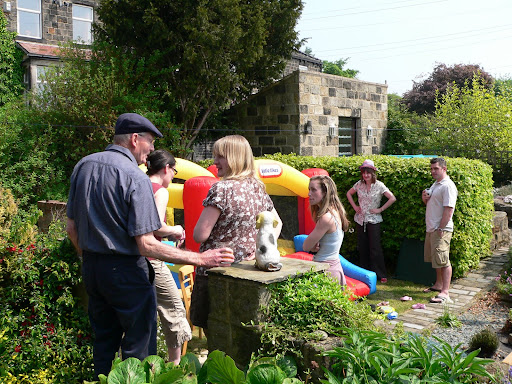
Opening of Castleford Bridge - 4th July 2008

Sunday 12 October 2008

Support for the Primary Geography Quality Mark

I've been very active during the last month moderating the applications from Round 4 of the Geographical Association Primary Geography Quality Mark and providing additional support for teachers who are enrolled for Rounds 5 and 6 of the award.

An overview of the PGQM can be found on the
GA PGQM website. Additional support for teachers who are interested in primary geography is available on the PGQM password protected website - access to this website is available to all members of the GA and details of how to request a password are available from the main GA PGQM Site.

My most recent PowerPoint was produced for a PGQM teachers workshop and was aimed at encouraging teachers to think much more creatively about the kind of geography that they teach.

Thinking Geographically
View SlideShare presentation or Upload your own. (tags: guidance pgqm)

Public Profiler World Names Website


Public Profiler World Names: this website lets you discover how common your surname is around the world. Type in your surname and the website generates a world map to show how popular your name is. It's also possible to zoom in and have a look at regional variations. Keep an eye on the actual `numbers' as the colour coding on the maps can mask a great variety in the actual numbers. A fascinating website and easy to see how it could lead to some fascinating geography and history for that matter. For example, why is there a higher frequency of people per million with the name Church in New Zealand than in the UK? Why are there Hamblen's in the USA and not in Canada?

This site is worth a look.

Thursday 4 September 2008

Geograph: an image for every square kilometre in the UK

We’ve had a really good August at home this year walking local footpaths and finding places that we’ve never been to before, all within a 5 mile radius of home. The motivator for all of this activity has been the Geograph website.

If you are not familiar with the site, then the aim of Geograph is to collect photographs for every square kilometre within the UK. 88% of England, Scotland & Wales now have at least one photo per kilometre square and 22% of Ireland has been covered.

This is a really useful website if you need images of the UK, first because all images are shared under the Creative Commons License (this means that although the photographer owns the copyright they have agreed to other people using their images). Second because the images are a reasonable size (640 pixels wide) they are very useful for projecting on an interactive whiteboard. So forget those tiddly little snippets that you find through searching Google Images – most of which are covered by copyright – and nearly all of which are useless for projecting and start exploring Geograph.

So log-on to their website: www.geograph.org.uk

Choose a place – it’s not very good at recognising postcodes – so either the place name or a four figure Grid reference work best.

If you want to see where I’ve been walking, then you could start in the west on the Moorland above Langsett ( SE1800 in the search box or http://www.geograph.org.uk/gridref/SE1800 should take you directly there) and try working your way east towards the M1 motorway.

Monday 4 August 2008

Creating a `My Walks' Map using Google Maps

Several posts ago I provided a Slideshare PowerPoint to show how to use Quikmaps but I never got round to publishing a `How to create a map using Google My Maps'.

Google `My Maps' uses the Google Maps website as opposed to the downloadable `Google Earth' - so there is no need to download anything to your computer.

It is easy to add images into the hotspots that you create as long as your images link to a photo that is stored online, for example on the Geograph website or perhaps on Flickr or Picasa.

Follow the instructions on the presentation to learn how to create your own illustrated maps.

Create a map using Google `My Maps'
view presentation (tags: online mapping tags digital ict)


Additional guidance is available from Google

Friday 27 June 2008

Action Plan for Geography: teachers create geography resources for other teachers


There have been some fantastic resources shared by teachers who have attended the final day of the APG (Action Plan for Geography) Curriculum Making Conferences.

Rosemary Slack of Middleton Primary School in Leeds has shared some great stuff on `Recycling'. This was linked to a visit that she made to Skelton Grange Environment Centre in Leeds.

As their contribution to Citizenship two teachers, one from Bamford Primary School, Rochdale and the other from North Reddish Primary School, Stockport chose to focus on the `Who do we think we are project' that is being supported by the Historical Association and the Royal Geographical Society (RGS with IBG). You can find out more about this project by clicking on the link below:
Who do we think we are?

We also had some really interesting curriculum resources developed around the software mapping programme `Local Studies' and Rosemary Crocker from St Paul's Primary School has provided an amazing account of her work in the local area while several teachers chose to base their work around a village in India.

We are hoping to showcase the more developed projects on the Geography Teaching Today website which is the official website for the APG (Action Plan for Geography) - you will find these on the Teaching Ideas Page (this is an open website) where we already have a number of resources available for teachers of geography to view and download.

Meanwhile anyone who is a member of the Geographical Association can request access to our password protected website for Primary Geography. You will need to e-mail Julie Beattie to access this site. When she has checked out your membership details she will provide you with a user name and password. jbeattie@geography.org.uk

There's been lots going on


It's over a month since I last added a post to this blog and there has been so much happening that I've only just got round to completing this new post. It has been my grandsons second birthday which took place in his garden - complete with bouncy castle and a bounty of other toddlers (plus some quite grown up children). I had a few days in Spain around my birthday - visiting friends near Almunecar = and since then I've been incredibly busy at work on the Action Plan for Geography.

For work, I've been to Newcastle, Manchester, Birmingham and Cambridge for the last day of the APG `Curriculum Making Conferences' and have spent quite a few days putting some excellent teacher resources onto the Geographical Association password protected website. I'll add a new post about this work. I've also been editing additional resources for the Young Geographers Project - again I'll add a separate post for this. Keep looking - more to follow.

Monday 5 May 2008

The Ordnance Survey & Becta schools map pilot

The Ordnance Survey (OS) and Becta have been running a `map pilot' aimed at exploring ways of making digital maps accessible to schools.

The introduction on the E-map site reads:

`The MapPilot enables a range of Ordnance Survey digital mapping to be accessed free by pilot schools and educational mapping suppliers for a trial period. MapPilot is run by Becta, in conjunction with The Advisory Unit: Computers in Education and eMapSite with funding from DfES and support from Ordnance Survey.'

I'm currently registered with the map pilot in conjunction with Methodist J & I and I've finally got around to downloading some maps from the site and using them in conjunction with the software programme `Local Studies'.

The map I chose to use was the `Streetview' map of Wakefield, which was unknown to me before I became involved in the project. It is simple and clear and allows some additional information to be added to the map (via a simple GIS such as Local Studies) without appearing too cluttered and illegible.

We have used a `Streetview' map of the south side of Wakefield city to record our `Top Ten Places in Wakefield'. We also used images downloaded from the Geograph website to populate the hotspots.

`The Geograph British Isles project aims to collect geographically representative photographs and information for every square kilometre of Great Britain and Ireland.'

This is the first opportunity that the majority of the children in the class have had to link data to locations on a Wakefield map (as opposed to maps of the school grounds) and I have been delighted to find out how well many of the children can do this.

The PowerPoint embedded below illustrates work that we undertook during week 6 & 7 of my visits to the school. The children are now fairly accomplished users of Local Studies and the staff in the school like the programme.

(Though I'm still not convinced that I would recommend the software to schools in future as my feeling is that the software company is not keeping it sufficiently updated and compatible with modern school networks.)


Sunday 4 May 2008

Using `Local Studies' the story continues ...

I've just undertaken a further 3 weeks of work with Year 5 pupils at Methodist J & I, Wakefield. The children needed an opportunity to re-cap and remember how to use the programme. So during the first week of my visit we went back to drawing a map using the programme tools.

I was able to show them a few examples of work about the `local area' that had been undertaken in other schools. They were particularly interested in hearing that Year 1 at Shelley Primary School near Huddersfield had been using `Quikmaps' to record what happened in their village and additionally pleased to know that their own example had been the inspiration for other schools.

The PowerPoint in this post shows the work we started on the 16th April (after a gap of 4 months). I was really interested in the different styles of maps that the children had drawn and this PowerPoint is more of an exploration of what the children did, rather than `how to do' Local Studies.

Saturday 3 May 2008

Do you use online mapping to locate places? If so which ones?

The current round of voting has now closed. Nineteen people have registered their vote so far – which is pleasing because I recognise that this is a relatively unknown blog.

As might be anticipated Google Maps and Google Earth have achieved the highest scores (though only just) and Multi-Map is perhaps beginning to lose out. This overall score reflects my own current use of online mapping as I much prefer Google Maps to the re-vamped version of Multi-map.

One programme that is well worth a look is the Microsoft website, variously known as Live Local, Maps Live etc. This has not scored as well as Google maps yet for some parts of the country the satellite views are far more detailed than on Google Maps.

The current edition of Web User Magazine 24 April – 7 May 2008, Issue 186 (which I think is excellent), devotes 2 pages to getting the most from `Live Search Maps’, pp. 62-63

www.webuser.co.uk

Saturday 12 April 2008

The Young Geographers Project has been launched on the GA website

The first of our our Young Geographers project resources, written by Jane Mulligan of Austrey Primary School, Warwickshire has been added to the Geographical Association website. Click on the page image to be taken to the website.

This new project for primary schools focuses on four key areas: engaging in practical curriculum making, 'living geography', Learning Outside the Classroom and Education for Sustainable Development.

An earlier reference to the Sheffield Project can be found in a post I made on this site in January.

Further information about the work of the Canterbury Project can be found on the blog of my colleague Paula Owens.

Wednesday 2 April 2008

Geographical Association Conference

Life has been very busy during the last month so it's almost a month since I lasted shared anything through this blog.

I've just returned from the annual Geographical Association Conference which was held in Guildford this year. It was attended by over 700 people and the overwhelming feeling is that the conference was a real success. Kate Russell and I ran a workshop on behalf of the ICT working group with thirty + enthusiastic geographers attending. Our message to the group was that we need to extend the use of online mapping in the primary classroom. I was able to provide an overview of the work I've been doing with the Y5 class on using Local Studies and Quikmaps. see the embedded PowerPoint below:


Find out more about the conference presentations at:
http://www.geography.org.uk/events/annualconference

See below for a quick guide to creating a personalised map using Quikmaps

Saturday 8 March 2008

Please Keep Voting + some new websites

Please can I say a very big thank you to people for voting for the web based map programme that they use. I'm finding this really helpful - so anyone who reads this who hasn't yet voted please can you do so.

I've been exploring two websites that are totally new to me this morning and one that I've seen before but haven't used much.

The first one is a mash up of Google Maps and Flickr called Flickrvision
This shows the latest images posted to the Flickr website over a Google Map. Choose the 3D view and you see a view of the Earth from space. This is fantastic because it shows which parts of the globe have night and which day. It's quite fascinating to see images pop up from different parts of the world.

The second is called WalkJogRun
and enables you to trace a route on a Google Map. It measures the distance, records your route and tell you how long it will take you to complete the journey depend on your speed of travel. Great for walkers and runners but also very useful for route planning activities in the classroom.

The third programme is called Flash Earth and allows you to view your chosen location via a number of different online mapping programmes. Add a comment after this post to let me know if you have found any of these websites useful.

Saturday 16 February 2008

Curriculum Making from Cambridge: using Local Studies

Sharing a personal `Learning Journey’

Sue Kelly, a teacher from King’s Lynn, shares how she embarked on the process of learning to use the software programme `Local Studies' through this PowerPoint.

Sue attended the second round of the Geographical Association Curriculum Making Conferences in Cambridge. (These CPD events were offered as part of the Action Plan for Geography.) The Primary ICT sessions were developed around the use of Local Studies Software (Soft Teach Education) andteachers who attended the first day of the course needed to go onto develop their own understanding of the programme in order to use it with children they would be teaching.


If anyone else has developed resources using Local Studies software that they would be willing to share - please e-mail me at wnorth@geography.org.uk.

Tuesday 29 January 2008

Geography & Food: starting from stories

Stories provide a wonderful way of proving the `hook' that gets children engaged with learning. The PowerPoint focuses on some of the books I've used and enjoyed and suggests ways that geographical understanding can be developed through story.


Monday 28 January 2008

Workshop: Geography & Food

My workshop focus for the Outwood Pyramid Conference on the 25th January was `Geography and Food'. This was a shared workshop aimed to encourage teachers to make links between geography and `food preparation. (More cooking/ healthy eating than food technology.)

The PowerPoint that I used to summarise the focus of my planning is shown below:


There are a number of projects linked to food and farming on the Oxfam Education website, including Making a Meal of It. Activity 5: Unpacking the supermarket bag is referred to on slide 6 of the presentation.

There are lots of links to online materials for teaching about food. Some are strongly geography focused while others focus more clearly on other curriculum areas, e.g. science. I'll be sharing some of these links on this blog over the next few weeks. If you have successfully taught geography through a food topic why not contribute your ideas.

Reflections on a Primary Cross-Curricular & Creativity Conference

On Friday 25th January I took part in a conference for a pyramid of Wakefield schools. What follows are a few of my thoughts linked to the keynote presentation.


The first thing that strikes me is the influential role of some of the independent educational consultancies in shaping the direction that primary schools take when reviewing their curriculum. In this case our conference was led by a well regarded keynote speaker from a prominent commercial education consultancy. I heard some conflicting messages.

Some were excellent, i.e. we need to provide `hooks’ at the beginning of a new (topic/ unit/ theme/ project) to ensure children engage with the learning; use questions to focus learning; engage with the local area; help children to make connections about their learning experiences so that they are joined up and make sense in their minds; provide opportunities for pupils to share `what they know’, e.g. through making a video to show to other children in the school.

While others messages appeared muddled, i.e. the synonymous use of literacy/ English and numeracy/ mathematics; the use of sub-grades in subjects such as geography (what exactly does a 5c look like?) and very definitely the Primary School Year 3 planning for geography, `How will Global Warming change my life?’

[I want to return to two of these areas, i.e. the ones that relate to assessment in geography and to Global Warming in a later entry.]

So, do the solutions to the primary curriculum lie with the published advice and guidance that commercial educational organisations provide or do the solutions lie with teachers in the classroom who know their pupils and want to provide a curriculum that starts with the child and takes into account the needs of the child and the community in which the child grows up?

Wednesday 23 January 2008

Books & websites for developing an understanding of Global Citizenship and Education for Sustainable Development

It was great to meet so many enthusiastic teachers at yesterday's Quality Geography Conference in London.

One of the things we discussed was using books as starting points for learning in geography and I offered to make a book and website list available through this site. Click on the link below (green text) to access a WORD document which lists a selection of books and websites on the theme:

Global Citizenship and Education for Sustainable Development


Sunday 20 January 2008

Young Geographers - access to Word documents


The Word documents that were shared on the first day of the Young Geographers Project in Sheffield can be accessed by clicking on the highlighted link.

See below for access to PowerPoint presentations from the day.

Saturday 19 January 2008

Planning with `big ideas'

The focus for the second session of the `Young Geographers' project was `Planning with `big ideas' or key concepts. (See below for the introductory post on this subject.)

Currently KS3 are being asked to focus their planning for geography around key concepts. Paula Owens (my job share partner) and I have been thinking about whether a similar approach could be useful in the primary school. We believe that the use of `concepts' as a planning tool might help ensure that geography does not disappear from the curriculum if schools move towards cross-curricular approaches to learning.

The first half of the presentation exemplifies the idea of planning from key concepts or `big ideas.

The second half of the presentation shows `Living Geography' in action in school.

The last three slides provide guidance for project members on the format for writing up their materials to be included on the GA project page - Young Geographers

Primary Young Geographers Project

Via funding from the TDA we have been able to offer a new pilot project called `Young Geographers'. Two project groups are currently running, one in Canterbury (course leader Paula Owens) and one in Sheffield where I am course leader. I'm using this blog page to share ideas from my project group.

Additional information will be shared via the main GA project page website:

We had a very succesful first day yesterday which helped to get the project off to a very positive start. Through the project we are empasising four main elements:

· Engaging in practical 'curriculum making'

· Capturing the sense of motivating 'living geography'

· Learning Outside the Classroom

· Education for Sustainable Development

My introductory presentation was designed to promote reflection on what we might mean when we talk about `Living Geography' and what kinds of activities teachers are using to develop this approach in the primary classroom.

View `Living Geography' presentation.


The notes that follow may help you to make sense of some of the thinking that went into the presentation:

  • Who am I? Why focusing on `identity’ is a valuable place to start when thinking geographically.

· The link between place and identity, i.e where we grow up is a key factor in shaping our identity

· The importance of engaging young people with their own place and supporting them to explore their feelings about the place – Quikmaps example, Wakefield. Internet mapping that directly allows an exploration of place and space.

· Involving young people in `changing places’ – the importance of feeling that you can make a difference to your community, learning how change happens, what’s involved, making change happen (making learning real - not just another `school' activity)

· The importance of geographical imagination to the way we think about `place’ – location, first hand-experience, the way the world is represented to us and our emotional response to places are all important factors in shaping our geographical imaginations. Actual journey’s (fieldwork) and virtual journeys (role-play, drama, imaginative engagement with photographs) are valuable classroom activities that both inform and extend our geographical imagination.

· Discussions with others can help us to re-think the way that the world has been represented to us - `What image comes into your head when you are asked to think about Iran?’ [P4C can be a very supportive classroom strategy.]

  • Our concluding slides ask you to think about `school geography’ and experience of geography in our everyday lives – which kind of experience do we want for the children we teach?