Thursday, 21 October 2010
Blipfoto: reading and creating photo journals
I realise that I've been rather negligent of this blog since June and I'd just like to say that it's not all down to my new obsession with `Blipfoto'. I really have been very busy and when I get a few more minutes I'll share some of the ideas linked to my new project: Geography and the Global Dimension.
However - I have become a little obsessed with this photo-blogging or photo-journaling website since a friend told me about it. There are several things that appeal to me about the website: first it keeps me in touch with a friend who now lives in Spain and we can share some of the things that interest us (I know many people use Facebook to do this but I quite like the different `tone' of Blipfoto), second I can keep my own journal which I hope to be able to look back to in future years and third MOST IMPORTANT from my point of view is that I can read the journals and look at the images of people who live in and beyond the UK. Doreen Massey (OU Emeritus Professor of Geography) said something like `Space' is the meeting point of a thousand stories and Blipfoto certainly is that. One of my favourite journals is written by HPX who lives in New Zealand. It has felt quite a privilege to read her journal entries about the latest New Zealand earthquake and to gain a sense of how the earthquake has affected her and the people of Christchurch and district. I hadn't realised how long and how frequent the aftershocks of an earthquake can be. It has been a real eye-opener for me to read her entries and see the way she weaves in the normality of everyday life with the constant terrifying threat of what the next `rattler' might bring.
I also love the story of `Brian the Snail' - why not follow his adventures for the rest of the week. I think this very simple tellingof a photo-story is something that we could use with children.
Friday, 25 June 2010
Mountain views taken in Banff - Using Microsoft Photosynth
You can find out more about how to do this on his blog: http://mikemcsharry.com/2009/11/12/leicestershire-photosynths/
Saturday, 6 March 2010
A view from the top!
We went up on the Sheffield `Big Wheel' yesterday for the first time as we felt the weather was quite good. The aerial photos are on Flickr - not great images as the light was dodgier than I thought and the perspex exterior of the carriage was badly scratched.
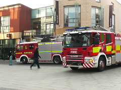
There was a whole lot of drama around Coles (John Lewis) (yesterday) with fire engines as well as a BBC mobile unit (which was on the spot by sheer coincidence). Apparently there was a small electrical fire in perfumery - info courtesy of the Sheffield Forum where you can find out much you want to know and very definitely a whole heap that you never needed to know - especially from anonymous writers.
Sunday, 10 January 2010
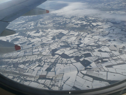
UK snow 2009 - field boundaries tessellate in the landscape below.
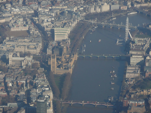
River Thames - photographed on flight from Manchester to Heathrow
Flight from Manchester to Heathrow
Soggy greens and browns appear as we take off … quickly followed by field patterns that tessellate black and white below.
Twenty minutes into our journey the River Thames comes into view and familiar London landmarks appear below.
Finally we arrive at Heathrow airport – Terminal 5 where flashing screens and pink butterflies distract us while we wait.
(These photographs were taken in February 2009 en-route to India. They form part of the India collection that I'm slowly uploading to Flickr. I thought that teachers might find them useful as some of them show field and settlements patterns in the snow below. There are also some very useful images of landmarks along the River Thames.)
Friday, 1 January 2010
Helping children to understand the diversity of India
Wednesday, 30 December 2009
Updating my Flickr pages with images stored on my computer
I've been spending some time over Christmas adding images to Flickr. I've got thousands of images stored on my computer (most of which are backed up elsewhere).
Apparently there are now more digital photographs in the world than house bricks!!
You can view my latest updated images within the Flickr badge at the top of the left column. This provides a direct link to my Flickr pages.
Tuesday, 29 December 2009
Silvepura - A village in India
Monday, 21 December 2009
Christmas Greetings
Ideas for using images
Friday, 30 October 2009
Finding high quality images for geography
Saturday, 3 October 2009
`MapIT Picture IT Write IT' seminar at the 2009 TES Education Show in London
It was really good to meet everyone at my seminar session at Olympia yesterday and absolutely fantastic to meet so many people who are enthusiastic about geography. I've updated the PowerPoint and credited photographers & schools where appropriate. I'll send everyone who left me their e-mail address a copy of the PowerPoint (probably later this week) and I'll also be sending you an invitation to join the Primary Geography Champions NING - though if you don't want to wait you can click on the link above and register today. If you'd like to contact me directly my contact details are on the Geographical Association website.
The PowerPoint has been split into two halves to make the download size more manageable:
Saturday, 15 August 2009
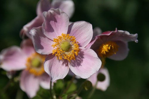
Japanese Anenome, Garden August 2009
I'm taking a well earned rest from geography for a few weeks over the summer. I've been experiementing with close up flower shots in the garden. I thought it was time that I used a few different settings on the SLR rather than using it in program mode all of the time. I was quite pleased with some of these images so I've added them onto my Flickr site.
Thursday, 21 May 2009
Nelamangala Market
Friday, 13 March 2009
In the Picture
I have been developing activities around the use of ICT frames for some years now. The idea being that the teacher inserts an appropriate image into a pre-created ICT framework.
I wrote a CPD unit on this theme a couple of years ago which can be viewed at Geography Teaching Today website and I've added other resources at various times to the Geographical Association website under the heading Visual Geography
In my introduction to the day I shared with the teachers some thinking about the links between visual literacy and print based literacy, drawing on an chapter in the GA Primary Geography handbook that was written by Margaret Mackintosh. You can view the introductory PowerPoint below:
Thursday, 5 February 2009
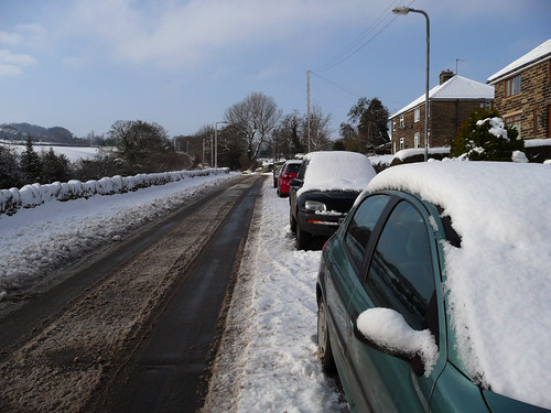
Crane Moor in the snow
Being a part-time worker has it's advantages and meant that I could go out for a walk instead of struggling into the office in Sheffield.
Sunday, 21 December 2008
PicLits

See the full PicLit at PicLits.com
Monday, 13 October 2008
The opening of the new Castleford Bridge - 4th July 2008
![]() |
| Opening of Castleford Bridge - 4th July 2008 |
Thursday, 4 September 2008
Geograph: an image for every square kilometre in the UK
We’ve had a really good August at home this year walking local footpaths and finding places that we’ve never been to before, all within a 5 mile radius of home. The motivator for all of this activity has been the Geograph website.
If you are not familiar with the site, then the aim of Geograph is to collect photographs for every square kilometre within the UK. 88% of England, Scotland & Wales now have at least one photo per kilometre square and 22% of Ireland has been covered.
This is a really useful website if you need images of the UK, first because all images are shared under the Creative Commons License (this means that although the photographer owns the copyright they have agreed to other people using their images). Second because the images are a reasonable size (640 pixels wide) they are very useful for projecting on an interactive whiteboard. So forget those tiddly little snippets that you find through searching Google Images – most of which are covered by copyright – and nearly all of which are useless for projecting and start exploring Geograph.
So log-on to their website: www.geograph.org.uk
Choose a place – it’s not very good at recognising postcodes – so either the place name or a four figure Grid reference work best.
If you want to see where I’ve been walking, then you could start in the west on the Moorland above Langsett ( SE1800 in the search box or http://www.geograph.org.uk/gridref/SE1800 should take you directly there) and try working your way east towards the M1 motorway.
Monday, 4 August 2008
Creating a `My Walks' Map using Google Maps
Google `My Maps' uses the Google Maps website as opposed to the downloadable `Google Earth' - so there is no need to download anything to your computer.
It is easy to add images into the hotspots that you create as long as your images link to a photo that is stored online, for example on the Geograph website or perhaps on Flickr or Picasa.
Follow the instructions on the presentation to learn how to create your own illustrated maps.
Additional guidance is available from Google