



 |
| Opening of Castleford Bridge - 4th July 2008 |
Monday, 13 October 2008
The opening of the new Castleford Bridge - 4th July 2008
I'm experimenting with adding a link to my Picassa photo album into this post. Click on the image to access the photo-gallery.


Sunday, 12 October 2008
Support for the Primary Geography Quality Mark
I've been very active during the last month moderating the applications from Round 4 of the Geographical Association Primary Geography Quality Mark and providing additional support for teachers who are enrolled for Rounds 5 and 6 of the award.
An overview of the PGQM can be found on the GA PGQM website. Additional support for teachers who are interested in primary geography is available on the PGQM password protected website - access to this website is available to all members of the GA and details of how to request a password are available from the main GA PGQM Site.
My most recent PowerPoint was produced for a PGQM teachers workshop and was aimed at encouraging teachers to think much more creatively about the kind of geography that they teach.
An overview of the PGQM can be found on the GA PGQM website. Additional support for teachers who are interested in primary geography is available on the PGQM password protected website - access to this website is available to all members of the GA and details of how to request a password are available from the main GA PGQM Site.
My most recent PowerPoint was produced for a PGQM teachers workshop and was aimed at encouraging teachers to think much more creatively about the kind of geography that they teach.
Public Profiler World Names Website

Public Profiler World Names: this website lets you discover how common your surname is around the world. Type in your surname and the website generates a world map to show how popular your name is. It's also possible to zoom in and have a look at regional variations. Keep an eye on the actual `numbers' as the colour coding on the maps can mask a great variety in the actual numbers. A fascinating website and easy to see how it could lead to some fascinating geography and history for that matter. For example, why is there a higher frequency of people per million with the name Church in New Zealand than in the UK? Why are there Hamblen's in the USA and not in Canada?
This site is worth a look.
Thursday, 4 September 2008
Geograph: an image for every square kilometre in the UK

We’ve had a really good August at home this year walking local footpaths and finding places that we’ve never been to before, all within a 5 mile radius of home. The motivator for all of this activity has been the Geograph website.
If you are not familiar with the site, then the aim of Geograph is to collect photographs for every square kilometre within the UK. 88% of England, Scotland & Wales now have at least one photo per kilometre square and 22% of Ireland has been covered.
This is a really useful website if you need images of the UK, first because all images are shared under the Creative Commons License (this means that although the photographer owns the copyright they have agreed to other people using their images). Second because the images are a reasonable size (640 pixels wide) they are very useful for projecting on an interactive whiteboard. So forget those tiddly little snippets that you find through searching Google Images – most of which are covered by copyright – and nearly all of which are useless for projecting and start exploring Geograph.
So log-on to their website: www.geograph.org.uk
Choose a place – it’s not very good at recognising postcodes – so either the place name or a four figure Grid reference work best.
If you want to see where I’ve been walking, then you could start in the west on the Moorland above Langsett ( SE1800 in the search box or http://www.geograph.org.uk/gridref/SE1800 should take you directly there) and try working your way east towards the M1 motorway.
Monday, 4 August 2008
Creating a `My Walks' Map using Google Maps
Several posts ago I provided a Slideshare PowerPoint to show how to use Quikmaps but I never got round to publishing a `How to create a map using Google My Maps'.
Google `My Maps' uses the Google Maps website as opposed to the downloadable `Google Earth' - so there is no need to download anything to your computer.
It is easy to add images into the hotspots that you create as long as your images link to a photo that is stored online, for example on the Geograph website or perhaps on Flickr or Picasa.
Follow the instructions on the presentation to learn how to create your own illustrated maps.
Google `My Maps' uses the Google Maps website as opposed to the downloadable `Google Earth' - so there is no need to download anything to your computer.
It is easy to add images into the hotspots that you create as long as your images link to a photo that is stored online, for example on the Geograph website or perhaps on Flickr or Picasa.
Follow the instructions on the presentation to learn how to create your own illustrated maps.
Create a map using Google `My Maps'
view presentation (tags: online mapping tags digital ict)
Additional guidance is available from Google
Additional guidance is available from Google
Friday, 27 June 2008
Action Plan for Geography: teachers create geography resources for other teachers

There have been some fantastic resources shared by teachers who have attended the final day of the APG (Action Plan for Geography) Curriculum Making Conferences.
Rosemary Slack of Middleton Primary School in Leeds has shared some great stuff on `Recycling'. This was linked to a visit that she made to Skelton Grange Environment Centre in Leeds.
As their contribution to Citizenship two teachers, one from Bamford Primary School, Rochdale and the other from North Reddish Primary School, Stockport chose to focus on the `Who do we think we are project' that is being supported by the Historical Association and the Royal Geographical Society (RGS with IBG). You can find out more about this project by clicking on the link below:
Who do we think we are?
We also had some really interesting curriculum resources developed around the software mapping programme `Local Studies' and Rosemary Crocker from St Paul's Primary School has provided an amazing account of her work in the local area while several teachers chose to base their work around a village in India.
We are hoping to showcase the more developed projects on the Geography Teaching Today website which is the official website for the APG (Action Plan for Geography) - you will find these on the Teaching Ideas Page (this is an open website) where we already have a number of resources available for teachers of geography to view and download.
Meanwhile anyone who is a member of the Geographical Association can request access to our password protected website for Primary Geography. You will need to e-mail Julie Beattie to access this site. When she has checked out your membership details she will provide you with a user name and password. jbeattie@geography.org.uk
There's been lots going on
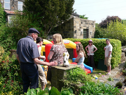

It's over a month since I last added a post to this blog and there has been so much happening that I've only just got round to completing this new post. It has been my grandsons second birthday which took place in his garden - complete with bouncy castle and a bounty of other toddlers (plus some quite grown up children). I had a few days in Spain around my birthday - visiting friends near Almunecar = and since then I've been incredibly busy at work on the Action Plan for Geography.
For work, I've been to Newcastle, Manchester, Birmingham and Cambridge for the last day of the APG `Curriculum Making Conferences' and have spent quite a few days putting some excellent teacher resources onto the Geographical Association password protected website. I'll add a new post about this work. I've also been editing additional resources for the Young Geographers Project - again I'll add a separate post for this. Keep looking - more to follow.
Subscribe to:
Posts (Atom)

 Posts
Posts

