Monday, 5 May 2008

The Ordnance Survey & Becta schools map pilot

The Ordnance Survey (OS) and Becta have been running a `map pilot' aimed at exploring ways of making digital maps accessible to schools.

The introduction on the E-map site reads:

`The MapPilot enables a range of Ordnance Survey digital mapping to be accessed free by pilot schools and educational mapping suppliers for a trial period. MapPilot is run by Becta, in conjunction with The Advisory Unit: Computers in Education and eMapSite with funding from DfES and support from Ordnance Survey.'

I'm currently registered with the map pilot in conjunction with Methodist J & I and I've finally got around to downloading some maps from the site and using them in conjunction with the software programme `Local Studies'.

The map I chose to use was the `Streetview' map of Wakefield, which was unknown to me before I became involved in the project. It is simple and clear and allows some additional information to be added to the map (via a simple GIS such as Local Studies) without appearing too cluttered and illegible.

We have used a `Streetview' map of the south side of Wakefield city to record our `Top Ten Places in Wakefield'. We also used images downloaded from the Geograph website to populate the hotspots.

`The Geograph British Isles project aims to collect geographically representative photographs and information for every square kilometre of Great Britain and Ireland.'

This is the first opportunity that the majority of the children in the class have had to link data to locations on a Wakefield map (as opposed to maps of the school grounds) and I have been delighted to find out how well many of the children can do this.

The PowerPoint embedded below illustrates work that we undertook during week 6 & 7 of my visits to the school. The children are now fairly accomplished users of Local Studies and the staff in the school like the programme.

(Though I'm still not convinced that I would recommend the software to schools in future as my feeling is that the software company is not keeping it sufficiently updated and compatible with modern school networks.)



Sunday, 4 May 2008

Using `Local Studies' the story continues ...

I've just undertaken a further 3 weeks of work with Year 5 pupils at Methodist J & I, Wakefield. The children needed an opportunity to re-cap and remember how to use the programme. So during the first week of my visit we went back to drawing a map using the programme tools.

I was able to show them a few examples of work about the `local area' that had been undertaken in other schools. They were particularly interested in hearing that Year 1 at Shelley Primary School near Huddersfield had been using `Quikmaps' to record what happened in their village and additionally pleased to know that their own example had been the inspiration for other schools.

The PowerPoint in this post shows the work we started on the 16th April (after a gap of 4 months). I was really interested in the different styles of maps that the children had drawn and this PowerPoint is more of an exploration of what the children did, rather than `how to do' Local Studies.

Saturday, 3 May 2008

Do you use online mapping to locate places? If so which ones?

The current round of voting has now closed. Nineteen people have registered their vote so far – which is pleasing because I recognise that this is a relatively unknown blog.

As might be anticipated Google Maps and Google Earth have achieved the highest scores (though only just) and Multi-Map is perhaps beginning to lose out. This overall score reflects my own current use of online mapping as I much prefer Google Maps to the re-vamped version of Multi-map.

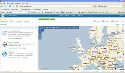
One programme that is well worth a look is the Microsoft website, variously known as Live Local, Maps Live etc. This has not scored as well as Google maps yet for some parts of the country the satellite views are far more detailed than on Google Maps.

The current edition of Web User Magazine 24 April – 7 May 2008, Issue 186 (which I think is excellent), devotes 2 pages to getting the most from `Live Search Maps’, pp. 62-63

www.webuser.co.uk