Friday, 2 April 2010
Open Data: new map site from the Ordnance Survey
The Ordnance Survey has now made some of their map data freely available for viewing, download and embedding into other web projects.
You can read more about this project on the Guardian website >>>>
I've had a very quick look this afternoon and I'm not totally sure how useful I'll find it - though it may be too early days yet. I started with Street View, a very attractive street map, which I've used very successfully with children during the OS/BECTA map pilot for schools. The map displays very quickly but in a long narrow band which restricts visibility.
I tried downloading the SE grid square (100k square) and as this turned out to be 800+mb in size I quickly stopped downloading on my very slow broadband connection.
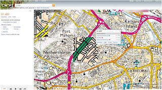
I'm sure that I need to give this website a little more time yet but as I can access OS 1:25000 and 1:50000 maps via BING maps (and these display at full screen size) I'm not entirely sure what use I'll make of the OS map data yet.
For secondary schools however, OS has made available different data sets which will work with GIS software which should make obtaining this data much easier than at present.
Subscribe to:
Comments (Atom)


