Friday, 27 June 2008

Action Plan for Geography: teachers create geography resources for other teachers


There have been some fantastic resources shared by teachers who have attended the final day of the APG (Action Plan for Geography) Curriculum Making Conferences.

Rosemary Slack of Middleton Primary School in Leeds has shared some great stuff on `Recycling'. This was linked to a visit that she made to Skelton Grange Environment Centre in Leeds.

As their contribution to Citizenship two teachers, one from Bamford Primary School, Rochdale and the other from North Reddish Primary School, Stockport chose to focus on the `Who do we think we are project' that is being supported by the Historical Association and the Royal Geographical Society (RGS with IBG). You can find out more about this project by clicking on the link below:
Who do we think we are?

We also had some really interesting curriculum resources developed around the software mapping programme `Local Studies' and Rosemary Crocker from St Paul's Primary School has provided an amazing account of her work in the local area while several teachers chose to base their work around a village in India.

We are hoping to showcase the more developed projects on the Geography Teaching Today website which is the official website for the APG (Action Plan for Geography) - you will find these on the Teaching Ideas Page (this is an open website) where we already have a number of resources available for teachers of geography to view and download.

Meanwhile anyone who is a member of the Geographical Association can request access to our password protected website for Primary Geography. You will need to e-mail Julie Beattie to access this site. When she has checked out your membership details she will provide you with a user name and password. jbeattie@geography.org.uk

There's been lots going on


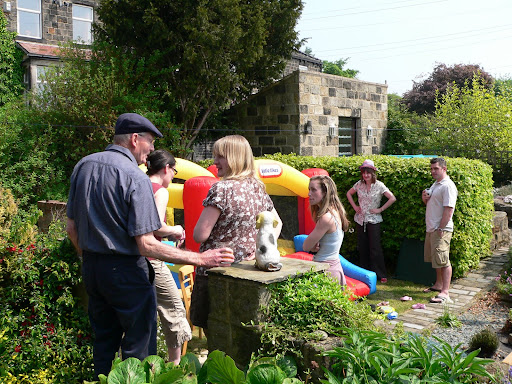
It's over a month since I last added a post to this blog and there has been so much happening that I've only just got round to completing this new post. It has been my grandsons second birthday which took place in his garden - complete with bouncy castle and a bounty of other toddlers (plus some quite grown up children). I had a few days in Spain around my birthday - visiting friends near Almunecar = and since then I've been incredibly busy at work on the Action Plan for Geography.

For work, I've been to Newcastle, Manchester, Birmingham and Cambridge for the last day of the APG `Curriculum Making Conferences' and have spent quite a few days putting some excellent teacher resources onto the Geographical Association password protected website. I'll add a new post about this work. I've also been editing additional resources for the Young Geographers Project - again I'll add a separate post for this. Keep looking - more to follow.

Monday, 5 May 2008

The Ordnance Survey & Becta schools map pilot

The Ordnance Survey (OS) and Becta have been running a `map pilot' aimed at exploring ways of making digital maps accessible to schools.

The introduction on the E-map site reads:

`The MapPilot enables a range of Ordnance Survey digital mapping to be accessed free by pilot schools and educational mapping suppliers for a trial period. MapPilot is run by Becta, in conjunction with The Advisory Unit: Computers in Education and eMapSite with funding from DfES and support from Ordnance Survey.'

I'm currently registered with the map pilot in conjunction with Methodist J & I and I've finally got around to downloading some maps from the site and using them in conjunction with the software programme `Local Studies'.

The map I chose to use was the `Streetview' map of Wakefield, which was unknown to me before I became involved in the project. It is simple and clear and allows some additional information to be added to the map (via a simple GIS such as Local Studies) without appearing too cluttered and illegible.

We have used a `Streetview' map of the south side of Wakefield city to record our `Top Ten Places in Wakefield'. We also used images downloaded from the Geograph website to populate the hotspots.

`The Geograph British Isles project aims to collect geographically representative photographs and information for every square kilometre of Great Britain and Ireland.'

This is the first opportunity that the majority of the children in the class have had to link data to locations on a Wakefield map (as opposed to maps of the school grounds) and I have been delighted to find out how well many of the children can do this.

The PowerPoint embedded below illustrates work that we undertook during week 6 & 7 of my visits to the school. The children are now fairly accomplished users of Local Studies and the staff in the school like the programme.

(Though I'm still not convinced that I would recommend the software to schools in future as my feeling is that the software company is not keeping it sufficiently updated and compatible with modern school networks.)


Sunday, 4 May 2008

Using `Local Studies' the story continues ...

I've just undertaken a further 3 weeks of work with Year 5 pupils at Methodist J & I, Wakefield. The children needed an opportunity to re-cap and remember how to use the programme. So during the first week of my visit we went back to drawing a map using the programme tools.

I was able to show them a few examples of work about the `local area' that had been undertaken in other schools. They were particularly interested in hearing that Year 1 at Shelley Primary School near Huddersfield had been using `Quikmaps' to record what happened in their village and additionally pleased to know that their own example had been the inspiration for other schools.

The PowerPoint in this post shows the work we started on the 16th April (after a gap of 4 months). I was really interested in the different styles of maps that the children had drawn and this PowerPoint is more of an exploration of what the children did, rather than `how to do' Local Studies.

Saturday, 3 May 2008

Do you use online mapping to locate places? If so which ones?

The current round of voting has now closed. Nineteen people have registered their vote so far – which is pleasing because I recognise that this is a relatively unknown blog.

As might be anticipated Google Maps and Google Earth have achieved the highest scores (though only just) and Multi-Map is perhaps beginning to lose out. This overall score reflects my own current use of online mapping as I much prefer Google Maps to the re-vamped version of Multi-map.

One programme that is well worth a look is the Microsoft website, variously known as Live Local, Maps Live etc. This has not scored as well as Google maps yet for some parts of the country the satellite views are far more detailed than on Google Maps.

The current edition of Web User Magazine 24 April – 7 May 2008, Issue 186 (which I think is excellent), devotes 2 pages to getting the most from `Live Search Maps’, pp. 62-63

www.webuser.co.uk

Saturday, 12 April 2008

The Young Geographers Project has been launched on the GA website

The first of our our Young Geographers project resources, written by Jane Mulligan of Austrey Primary School, Warwickshire has been added to the Geographical Association website. Click on the page image to be taken to the website.

This new project for primary schools focuses on four key areas: engaging in practical curriculum making, 'living geography', Learning Outside the Classroom and Education for Sustainable Development.

An earlier reference to the Sheffield Project can be found in a post I made on this site in January.

Further information about the work of the Canterbury Project can be found on the blog of my colleague Paula Owens.

Wednesday, 2 April 2008

Geographical Association Conference

Life has been very busy during the last month so it's almost a month since I lasted shared anything through this blog.

I've just returned from the annual Geographical Association Conference which was held in Guildford this year. It was attended by over 700 people and the overwhelming feeling is that the conference was a real success. Kate Russell and I ran a workshop on behalf of the ICT working group with thirty + enthusiastic geographers attending. Our message to the group was that we need to extend the use of online mapping in the primary classroom. I was able to provide an overview of the work I've been doing with the Y5 class on using Local Studies and Quikmaps. see the embedded PowerPoint below:


Find out more about the conference presentations at:
http://www.geography.org.uk/events/annualconference

See below for a quick guide to creating a personalised map using Quikmaps